Troublemint Peak Southeast Ridge 6/25/2019
Troublemint Southeast Ridge
20.66 Miles / 10:16:38 / 5950ft gain
This was one of those days where I remained indecisive 'til the very end - I wanted an easy approach, no shwack, and something I hadn't climbed before. Hurdy Gurdy seemed like a good idea, but when the day dawned with plenty of smokey haze from the Kenai wildfire, I decided to set my sights further north.
I figured I'd try one of the Mint peaks. The approach, Gold Mint trail, fit the bill as an easy, runnable approach, and the distance from the Kenai (hopefully) meant less smoke. The problem was which peak? After a quick look at Peakbagger, I decided to aim for Troublemint... Although the truth was, I didn't mind climbing whatever seemed possible and appealing upon seeing it.
I was on the trail and running towards Mint Hut just before 7am. The brush was remarkably dry, and miles passed quickly and pleasantly. Visibility was awesome, and I had a few good glimpses of the peaks ahead. I still wasn't quite sure which was which.
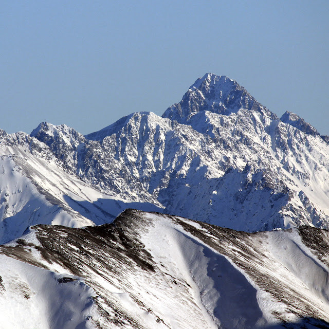
Coming to mile 8, it was time to stray from the trail and ascend a small chute to the moraine. It was beautiful up here! Small, beautiful blue melt pools, with the sound of rushing water a constant background noise. I began climbing snow on the south side of what I hoped was Troublemint.
 |
| Melt pool with algae. Troublemint background left |
Looking up to my left, I studied multiple gulleys on the peak. None of them seemed promising. I continued onward, hoping to find something better.
Finally, I noticed a likely looking, wide ramp up to a col. I went up this ramp, turned left, and eyed the southeast ridge ahead. It looked mellow for a while, and then steepened to a blocky band of rocks after a few hundred feet.
This steep area of rock proved to be the first low 5th class section. I took my time, and gave all the pieces hearty *WHACKS* with my palm before weighting them. Going right turned out to be the best option.
 |
| The ridgeline |
After this, I came to some very large blocks with deep pits between them. Passing these was fairly easy and secure.
Finally, I came to a butt clenching section of exposed ridge, with the inital few steps being the butt-clenching-est. The ridge eventually thickened back to a more respectable width, only to usher me on to the next trial...
A huge, challenging 5th class gendarme blocked the way, and I was terrified that this was the end. There was NO WAY I could climb up and down it without rope. After some contemplation, I managed to spy a bypass down to climbers right, but it involved some serious sideways downclimbing. Not for the faint of heart!
The terrain eased off for a while once past the gendarme, before once again becoming more technical and exposed. There was an awkwardly angled, less featured corner/dihedral on my right, but I chose to climb blockier and looser terrain on my left. After some low 5th/4th moves, I came to the tiny summit boulder.
 |
| Summit boulder! |
This boulder, I felt sure, must be the summit. I couldn't see anywhere higher. I figured I'd go up to it and take a look.
After some careful scrutiny, I decided I didn't like it at all. The obvious route had very small handholds, with friction footholds on dry moss. This didn't bode well for downclimbing ropeless!
Several abortive attempts later, I decided to take off my shoes and try it barefoot. Heck, if I'd known there would be moves like this, I would've brought rope AND ROCK SHOES. Even barefoot, I didn't like it. It was just too exposed. My grasp on the rock, the only thing keeping me alive, was too tenuous. Discouraged, I backed off. This was going to be worst asterisk of them all.
Then I remembered.
Keep looking around... You'll find a better way.
Dropping to the east side of the boulder, I skirted along a ledge, coming to the opposite side from where I had been before. Here, there were more moves, BUT! There were handholds!
Gripping a wedged rock, I carefully placed my bare feet on several sharp footholds, making sure to note their placement for the coming downclimb. A crack running on my left was the next goal, and I shimmied my hands, then feet into this reassuringly large space. One or two moves later, I was there. I was on the one person summit of Troublemint! I let out an emphatic, joyful whoop, spent a few minutes, and began to descend.
 |
| Summit Pano |
 |
| Summit rap anchor |
 |
| Downclimb imminent! |
 |
| The summit boulder |
 |
| The route I opted to take on the summit boulder |
Downclimbing was careful and controlled all the way back to the Col. I never felt I would fall, and I didn't move a single rock. Still, in hindsight, I should've done my research. It was a lot more difficult than I was expecting, and the margin for error was very low.
After a brief stop at the glacial melt "Mint Lagoon" I began my descent back to the Gold Mint trail. As I jogged back to the car, I couldn't help but take in the sights of Alaska in all its summertime glory - flowers, sun, mountains, snow, clouds, rain showers.
Man, I'm lucky to live here!
 |
| The Minty Lagoon |
 |
| Hershey's Kiss rock?? |
 |
| Lupins and mountains! |
 |
| Route details |


Comments
Post a Comment