Granite Peak Southwest Ridge - 3rd Time's the Charm!
Granite Peak Southwest Ridge - 3rd Time's the Charm!
5.8 miles/2.7k gain to base of peak
2.2 miles/3.4k gain on the actual peak
To put it mildly, this mountain has been elusive. My first attempt saw me high on the peak, reaching the top of a gendarme, only to see a thunderstorm quickly bearing down. Knowing how much fun mountain thunderstorms are (not), I turned back without hesitation. The second try was more of a long shot - the weather was wet and socked in, and the mountain had some early snow. No thanks.
I'd often wondered if I wanted to bother with a third try on Granite, but the promise of a long bike downhill sealed the deal (you can hike too, but it's less fun...) By 7 am on July 4th, I was driving toward Eska Falls.
Depending on what sort of vehicle you have, you may find yourself parking well before the real Eska trail begins. My Corolla isn't much of an offroader, so I always park in a small gravel lot before the pavement ends. The unpaved road is ROUGH!
Once on the unpaved road, you will want to keep bearing left/making left turns (small wooden signs guide you towards "HIKING"). Eventually, you'll reach a junction where the road splits into a motorized trail and the hiking/biking trail. The hiking trail is more pleasant - less steep, albeit longer. If you choose the hiking trail, get ready for a several miles of twisty turns, tight switchbacks, and some areas of brush.
As you break out of treeline, the mountain is clearly visible on the right, along with much of the SW ridge route. Having already done this approach several times before, I quickly brought my bike up to its usual hiding spot.
 |
| This is about where I ditched my bike. Granite is behind me, out of sight, while Eska Mountain is on the right. |
The initial climb heads up a grassy field, with long patches of turf meandering high up the peak. The easiest way up is to follow these patches, continuing on until the first rocks/cliffs rear up ahead of you, then making a right turn underneath these obstacles.
 |
| The first view of cliffs/gendarmes. The initial choss filled ascent gully is on the left, mostly out of sight. |
Once you've traversed right and through some large talus, you'll find yourself in a gully filled with choss. Head up, and trend climber's right as you gain elevation. After about 1000 feet of this, you'll come out into a wide talus field with a gendarme upward and on climber's right. Head for this gendarme!
Just before reaching the gendarme (literally right underneath it), traverse to the right of it. This is where the route gets tricky. You'll see a steep scree gully dropping downward into yet another, wider gully. Go down this steep gully.
 |
| The leftmost gendarme has the steep scree gully just below it, out of sight. Go down this gully and then straight back up the very next! |
Once you're safely down, you have to IMMEDIATELY head back up the very next scree gully - don't bother trying to bypass more than just that one gendarme. If you do, you'll be like me and end up having to climb/downclimb exposed 5th class boulders xD. I had to write an emergency message to Dan asking him WTF to do.
 |
| I just came down the snowy gully. The snow-free gully in the foreground (right next to it) is the one you want. In this photo, I had gone too far! |
 |
| Fifth class boulder moves I tried and then had to downclimb. I was messaging Dan from this vantage point and asking him what to do... |
If you've gone up the right gully, it will spit you out on the other side of the mountain, and from here, it all falls into place. The rest of the gendarmes are easily avoided on either side, and the climbing remains in the exposed 3rd/easy 4 class category. Once I bypassed these gendarmes, the summit came into view.
 |
| Looking back down at the gendarmes I finally bypassed |
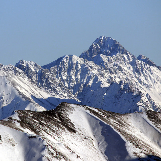
As I reached the summit, I was treated to beautiful views of both the Talkeetnas and the Chugach - Skybuster loomed proud to the south, and Apollo loomed proud to the north (I'm coming for you, Apollo).
 |
| Looking north. Apollo looming back there on the left. |
 |
| Skybuster/Ice Cream Cone looking appealing as ever |
 |
| Pano looking south. The sun stayed in the whole ascent... I'm not going to complain. |
Miraculously, the hot July sun stayed behind clouds for the whole ascent and most of the descent, which I was grateful for. Even so, I ended up drinking all of my 2 liters of water before getting back to the bike. It was a moderately thirsty, but entirely enjoyable shred back to the car.
 |
| The bike was waiting for me! Eska falls and Eska Mountain in the background. |

Comments
Post a Comment