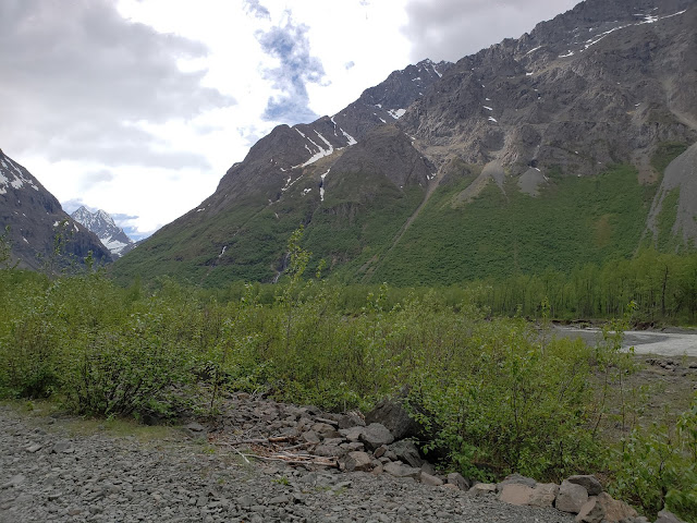
After a 13 hour day bushwacking Icicle Creek on Monday, a cloudy, windy, buttslide-y Indianhouse on Tuesday, and a hardcore Service bouldering sesh on Wednesday (OK, not THAT hardcore!) I needed one more peak to cap off the vacay. Benign!
Benign has had my attention for a while. It's a B peak, it's over 7k feet, and it seems straightforward with very rewarding sights on a clear day. I also had the good fortune of reading recent beta regarding snow conditions on Benign - it looked good to go, as long as you got up and down early! With a lot of snow remaining in the CSP, combined with hot June afternoons, the mountains are shedding. Ie, avalanching!
With that I mind, I was riding my bike around Eklutna by 5:30am and ditching it at Serenity Falls by 6:30am. Unlike Monday's misadventure, I had taken the time to have a good look at the route for Benign. That meant I felt confident in climbing fast, and pretty soon, I was on the massive moraine bench that circled around Benign to the SE gully.
Serenity Falls center left, with scree field and Dead Goat gully just to the right
Looking up Dead Goat gully
Above Deadgoat, ascending to the moraine.
It turns out the SE gully was an absolute mess of avalanche debris. The mere sight of it took me aback, and I wondered if I was too late despite my hurrying. After a couple hundred feet, it was obvious that the nasty snow was still completely frozen solid and safe to ascend. Keeping my eyes and ears peeled for signs of melt, I started upward, spurred by the fact I knew I was on a time limit.
Looking down the SE gully at frozen avy debris
I reached the summit quickly, with no sound or indication of the snowpack destabilizing. It seemed that the previous night or two had been very cold, as the bright morning sun did little to change the snow consistency... But enough about the snow! The views up here were simply stunning - Eklutna Lake, Bold, Bashful, Baleful, the Mitre, Eklutna glacier, far and wide into the park. It was incredible, and miraculously, the day was turning out wall to wall sunny without even the slightest breeze.
I spent a few minutes, and headed down.
Summit pano. Left to right - Eklutna lake, Bold, Bashful, Baleful, the Mitre, Ovis, Eklutna glacier, and Peril
Summit selfie.
Quick video. Didn't bring my usual camera gear and I regret it!
On the way back to Serenity, I stopped for some photos on the moraine bench. Hard to beat this vantage point! A bushplane or two flew between the Mitre and I, looking like tiny little specks compared to the scale of the mountains.
Beautiful sights!
Looking down at the entrance to Deadgoat
It was a sunny, pleasant ride back around Eklutna - one of those days where you just smile to yourself, completely happy and content with the world.
The first scary bit came in the form of a grizzly sow and cub crossing the road to ERNC. After 5 miles of hiking Crow Pass and yelling "HEY BEAR" with spray in hand, I came to Icicle Creek. This is where fumble #1 happened.
View of Nantina, Yukla, and Polar Bear (left to right) from Echo Bend
Another view of the same, this time from The Perch
Looking up Icicle Creek. I should have done more research and realized this is one of the most hated bushwacks in the park..
First I tried going climbers right, and was turned back by cliffs. Then I tried going climbers left, which turned into a maze of goat trails on top of loose scree cliffs. Eventually I found a weakness and got past the worst of it, but not before wasting a good few hours.
The trail become more distinct the further I got, and I found some cairns and signs of the alders being trimmed. This was encouraging and spurred me on to greater speeds.
Typical travel past the worst of the routefinding. There IS a trail of sorts hugging the cliff.
Eventually the trail meanders down to the water, and this intersection is marked with a cairn.
Eventually I came to Icicle valley, with views of Mt. Yukla's north face on my right and Nantina Point's south slopes on my left. I began scrambling up the typical Chugach scree towards Nantina.
The thicket is thinning, and I'm almost above treeline!
At long last... Easy travel! Icicle glacier on the left, Yukla on the right.
A magical place. Yukla right, Nantina scree slopes to the left.
Yukla northwest face. Richard Baranow, ie Mr. Chugach, has traversed this face!
This is where fumble # 2 happened. I noticed a gully to my left, and even footprints up this gully (probably from an ascent a few days prior) but I decided to keep going forward and perhaps find a better way to either Nantina and/or West Kiliak. WRONG!
After climbing up the initial scree slopes, I came to this cool little ridge.
A handy reference for where I went wrong. There were footprints in the gully to the left, but like a dummy I wanted to do my own thing and went right. DON'T do that, unless you know good things will happen.
Looking back down towards Yukla.
I eventually came to a big bowl, with some avalanche debris both to my left and right. The terrain on the left looked mellow enough if pieced together correctly, and the avalanche debris here was obviously from a few days prior when the sun was out and the temps were hot. I started my way up left, and soon reached a nice class 2/3 slope.
Some clouds moved in, and it began to snow lightly. Looking down to my left, I could see that my earlier gamble of finding a better way was probably NOT going to pan out, as the gully I had passed up before lead to a nice easy cirque... A cirque I now desperately wanted to reach! Still, I kept doggedly on, hope that this slope/ridgeline would pan out in the end.
NOPE!
I reached cliffs ahead, and there was zero prospect of downclimbing to the cirque on my left. I toyed with the idea of backtracking and climbing that gully I had passed, but I knew that this would turn into potentially an 18 hour day which I wasn't ready for. This is when I knew it was time to turn back.
This was nice and mellow enough, until it wasn't! Nantina is on my left, Kiliaks are on my right. Eventually this ridge turned evil and I tucked my tail and headed down.
Coming back down to Icicle valley, the snowshowers passed and the sun was out in full force. It was a glorious afternoon back down Icicle creek.
Taking off my "snow" gear - neoprene socks and mini gaiters.
ooohhh pretty flowers.
ohhhh pretty flowers, then a drop into the nasty Icicle gorge...
My bushwack duckface
What a view!
Routefinding near the waterfalls and cliffs of Icicle creek again gave me trouble, and once more I pieced together a nasty goat trail with some loose 4th class downclimbing. Tricky business... I now know of a much easier way past all of this ;)
Borderline 4th class with some nice crud thrown on top
It was a sunny, pleasant hike back to the car. The only bear I saw on the trail was a smallish blackbear that immediately ran away and climbed a tree. That's fine with me - I didn't like the idea of coming face to face with a momma grizzly.
I'll be back, and next time, take the right way!!
My thumbs up translates to "thank goodness I'm done with Icicle creek!"
Evening Perch
Fairytale forest
Back at ERNC! Eagle peak in the distance...
ROUTE STUFF:
OK, so honestly, you probably shouldn't be listening to me because I didn't make it. I can, however, tell you what NOT to do as illustrated in the photos below:
Mistake #1 - trying to find a trail near Icicle creek. It's pretty rough. I now know that the pros go around wide to the left, up onto the obviously flatter bench.
Mistake #2 - not following the small gully to the cirque below Nantina. This one was just pure stupidity on my part.