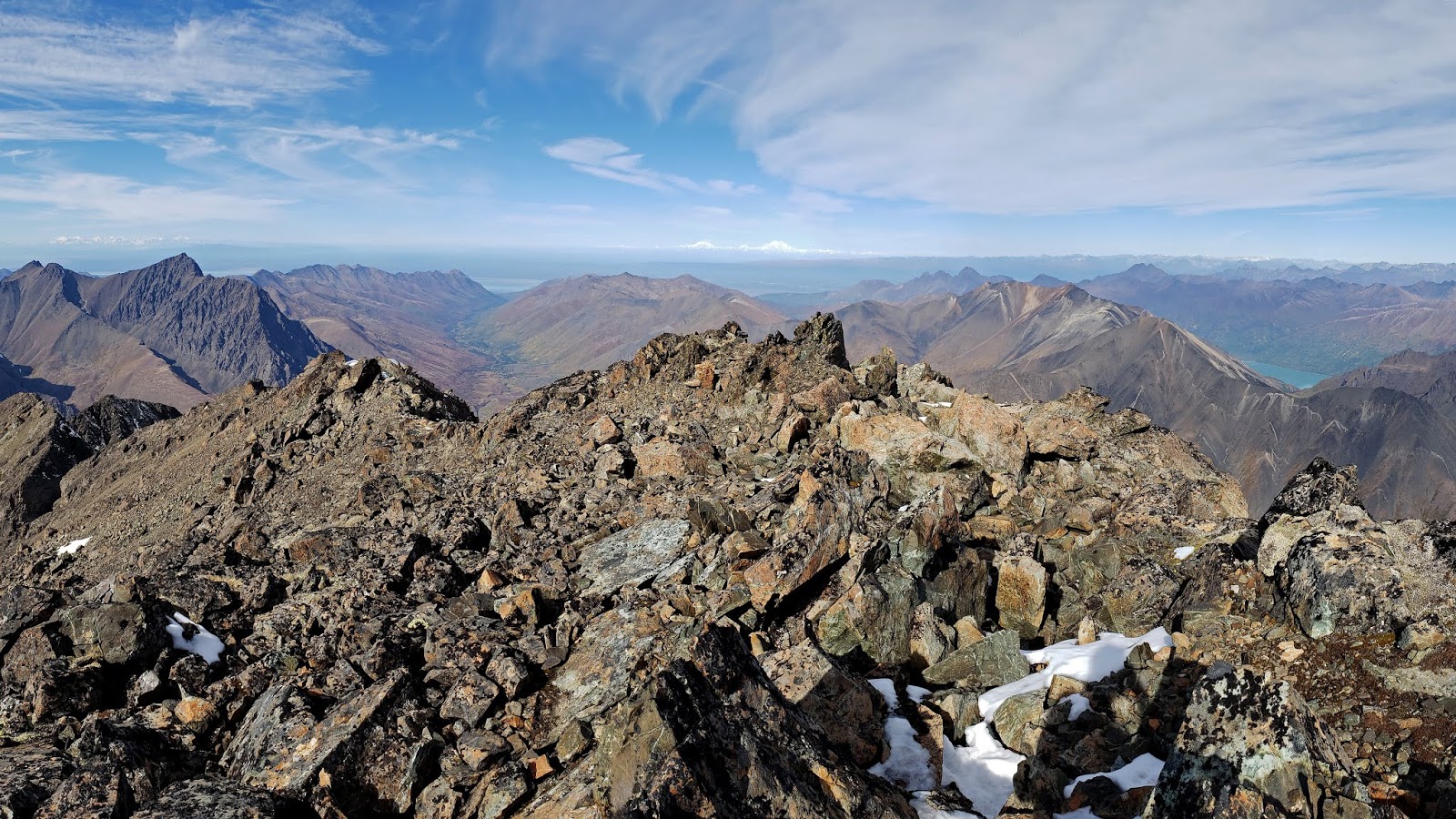
This was an absolute WHOPPER of a day - the most elevation gain I've ever done! Weather was nothing short of breathtaking the entire time. I even nailed the route dead on, except for some fumbling around on the rock glacier/Bombardment pass.
Traveling over Bombardment Pass on the way in, I thought it would be a good idea to get onto the ice/snow right under Korohusk. Well, yes, that would've been a good idea... With spikes! I had nothing, so I went full caveman and used a sharp rock to chop steps for myself.
It took me just over two hours from the Peter's Creek crossing to the summit of Rumble. The gully was an absolute slog, and the 4th class step out of it would have been far more interesting in wet weather. There's algae on them rocks!
Coming back over Bombardment was the real test. I was totally worked by the second time I came over! And this time I opted to descend the scree further toward Pleasant instead of chop more steps. Good idea. I now know that most people use a far easier and sneakier way around the rock glacier... Next time!
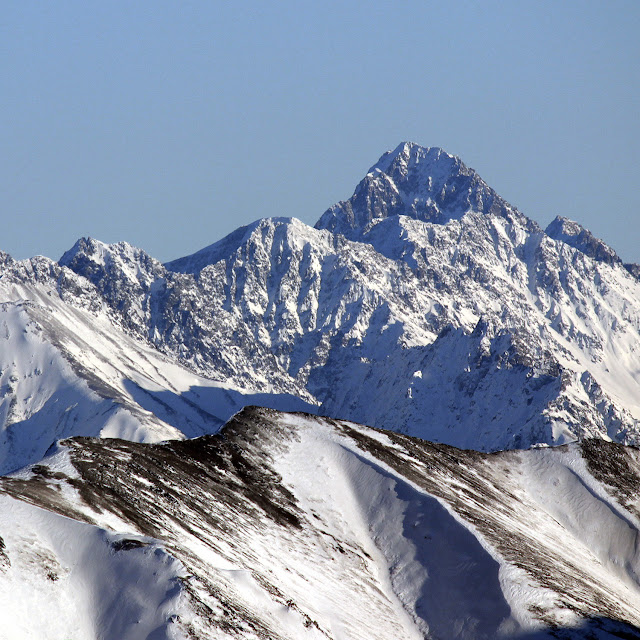
Morning in Ram Valley. Rock glacier/Korohusk/Cumulus on the right.
Skybuster/Ice Cream Cone seen from Mt. Significant, January 2019. LONG lens! I remember the first time I saw it. Eastbound on the Glenn, just before passing Kings Mountain and Chickaloon, on a clear, flat section of road, I happened to glance south, and there it was, standing tall in the distance. I couldn't take my eyes off, and couldn't help but wonder: did that insane tower of rock have a name, and what would it be like to stand on its incredible, precipitous summit? Since I wasn't driving, I easily answered the first question with Google. That inspirational behemoth was named Skybuster. Answering the second question, however, would have to wait. Several years and lots of beta gathering later, it was time to try. Since the peak is so remote, it seemed a good idea to make this our first fly in approach. With excitement and some apprehension, we loaded up at Merrill field and flew (choppered!) out. WOCKA WOCKA WOCKA Sitting in t...
Total Time - Just about 9.5 hours. 46 minutes biking in, 7:59:37 hiking, 46 mins biking out. Civic DX ready to roll! I left my house at 5:30 and was riding around Eklutna by 6:20. There was a lot of bear crap on the trail, so I did some extra "hey bear!" in addition to my two bearbells. After 10 miles, it was time to ditch the bike - but what was this? There were already some people here! A group of two declared their intention to climb Bold, and there was a group of three trying Bashful! Riding around the lake Trusty 9:ZERO:7 Whiteout with Bashful above! The two were still busy with gear, so I started walking with the trio, glad to have some company for what I had anticipated to be a very spooky (bear-ie) walk to Stiver's. Once we arrived, I bade farewell to the group and went on ahead. My Bashful Buds :) Things went great until I took a very ill-advised wrong turn, and ended up missing the alder tu...
Granite Peak Southwest Ridge - 3rd Time's the Charm! 5.8 miles/2.7k gain to base of peak 2.2 miles/3.4k gain on the actual peak To put it mildly, this mountain has been elusive. My first attempt saw me high on the peak, reaching the top of a gendarme, only to see a thunderstorm quickly bearing down. Knowing how much fun mountain thunderstorms are (not), I turned back without hesitation. The second try was more of a long shot - the weather was wet and socked in, and the mountain had some early snow. No thanks. I'd often wondered if I wanted to bother with a third try on Granite, but the promise of a long bike downhill sealed the deal (you can hike too, but it's less fun...) By 7 am on July 4th, I was driving toward Eska Falls. Depending on what sort of vehicle you have, you may find yourself parking well before the real Eska trail begins. My Corolla isn't much of an offroader, so I a...


Comments
Post a Comment