10 miles bike, 10 miles foot, and 10 miles out on bike. Bonus avalanche activity and alder rappeling!
Bashful (left) and Baneful (right)
Ahhh - the beginning of a three day weekend. And what better way to begin than by scoping out some B name peak approaches? Given the nature of Chugach bushwacking, there's a high level of certainty that any given approach will have at least some routefinding errors, so it made sense to go get a taste of the "B Peak Area" before trying to summit its larger denizens. Baneful peak, a 5500' (ie "small") peak in the midst of this area, seemed the obvious vantage point. By 8am, I was riding around the shore of Eklutna Lake toward Baneful.
Bold peak peeking boldly. OK, kill me for that one.
Leaving my bike at the start of East Fork, I was pleased to find that trailside brush was still quite low. It was earlier in the season than I had ever been back here, and what is typically a dense jungle by July was only ankle high. Fine with me - the overgrowth can be quite wet in the morning, leaving you soaked and guessing how many bears it may or may not contain.
Not too overgrown at all!
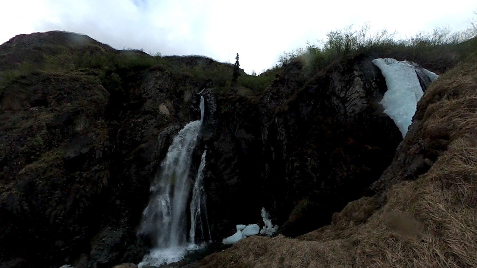
This was also the first time I had continued past Stiver's gully, and thankfully the trail stayed distinct all the way to Tulchina Falls at 2.5 miles in. Once I reached Tulchina, I'll admit I had no real idea of where I was going, except that I needed to stay to the right of the falls and aim towards Baneful, which towered above to the right.
Tulchina falls
I started climbing just to the right of the falls, and by chance I immediately noticed an overgrown trail marked with orange ribbon. Following this was certainly easier than a straight up bushwack, although getting my ice axe to clear some of the branches was a challenge. After a while, I came to a mossy cliff and turned left.
From here, the indistinct trail got steeper and wetter, and I noticed some dangling fixed rope from years gone by. Finally, the trail narrowed to a nasty moss chute, and for once, I was thankful for the alder handholds.
Wackin'
Leaving the moss and alder behind, I began ascending a large field of talus on Baneful's south side. This got steeper and steeper, forcing me to choose a gully and scramble up some kitty litter style pebbles. I eventually came to cliffs and turned left, skirting beneath the steep ground and up onto the west ridge of Baneful.
South slopes and west ridge
The initial going on the west ridge proved an excellent, confident scramble. As is typical with the Chugach, it's really hard to tell how difficult something is until you're right up on it, and I'm pleased to say that this turned out to be good fun with minimal danger.
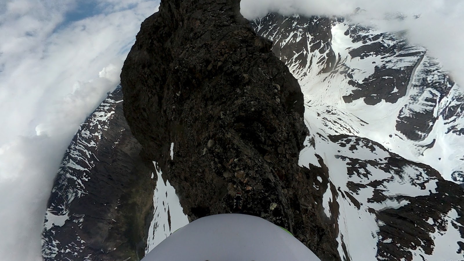
At the first high point in the ridge, I got a good view of the summit and travel ahead. There was some exposure to be had, but it stayed below perilous levels. All the same, I tested most of the more suspect rocks before weighting them, as being alone this far into the CSP warrants caution.
Exposed, but the wide angle makes it look worse than it is.
Finally, the ridge mellowed out into a big gentle field to the summit, and I quickly ascended to the snowy top of Baneful. From here, I was really hoping to get a good view of Baleful, the red spot glacier, and the east fork below to my right.
But no!
Clouds, lots of clouds. They had been present all day, shrouding the summits of Bashful and Bold. Baneful was no different. Everywhere I looked was cloud or hazy visions of trees, snow, and water below. From time to time there were breaks in the clouds, and I did catch a glimpse or two of Baleful. It looked positively menacing!
Summit socked in.
Only needed it a lil bit, and only then just to feel safer and keep hands out of snow.
It was warm!
All of a sudden, I heard a tremendous noise in the distance. Rockfall! Squinting through the mist, I caught sight of snow and rocks falling down the south side of Bashful. It was warm, and the mountains were shedding their winter coats. I was happy I only had minimal, shallow grade snow to cross. With the sound of rockfall a constant ambience, I backtracked my way down Baneful.
The views would have to wait.
Going back down through the alder trail, I had quite a lot of fun using the alders to rappel. This was probably the first time I had ever used this technique, and it worked awesomely. I also noticed, somewhat to my dismay, that the trail will indeed be quite overgrown in the coming weeks. There are Devil's Club plants all over it which have yet to grow leaves, although the thorns were still quite prickly...
Buttslide mania!
Raindrops are fallin on my... Helmet.
Rain showers moved in for my journey back to the car, and I got some sprinkles on both myself and my camera. It was warm, so I didn't mind in the slightest. I ended the day with a perfect evening ride around Eklutna, a great start to another summer in the Chugach.
Sunshowers on East Fork.
Pleasant, although my serious face says otherwise...
VIDEO
ROUTE STUFF -
Easy until you get to Tulchina, then a moderate bushwack/navigation crux until you break out of treeline. From there, climb the south side of Baneful and trend left to reach the west ridge. There's some exposure once you gain the ridge, but the going stays scrambly.
Skybuster/Ice Cream Cone seen from Mt. Significant, January 2019. LONG lens! I remember the first time I saw it. Eastbound on the Glenn, just before passing Kings Mountain and Chickaloon, on a clear, flat section of road, I happened to glance south, and there it was, standing tall in the distance. I couldn't take my eyes off, and couldn't help but wonder: did that insane tower of rock have a name, and what would it be like to stand on its incredible, precipitous summit? Since I wasn't driving, I easily answered the first question with Google. That inspirational behemoth was named Skybuster. Answering the second question, however, would have to wait. Several years and lots of beta gathering later, it was time to try. Since the peak is so remote, it seemed a good idea to make this our first fly in approach. With excitement and some apprehension, we loaded up at Merrill field and flew (choppered!) out. WOCKA WOCKA WOCKA Sitting in t...
Troublemint Southeast Ridge 20.66 Miles / 10:16:38 / 5950ft gain T his was one of those days where I remained indecisive 'til the very end - I wanted an easy approach, no shwack, and something I hadn't climbed before. Hurdy Gurdy seemed like a good idea, but when the day dawned with plenty of smokey haze from the Kenai wildfire, I decided to set my sights further north. I figured I'd try one of the Mint peaks. The approach, Gold Mint trail, fit the bill as an easy, runnable approach, and the distance from the Kenai (hopefully) meant less smoke. The problem was which peak? After a quick look at Peakbagger, I decided to aim for Troublemint... Although the truth was, I didn't mind climbing whatever seemed possible and appealing upon seeing it. I was on the trail and running towards Mint Hut just before 7am. The brush was remarkably dry, and miles passed quickly and pleasantly. Visibility was awesome, and I had a few good glimpses o...
Granite Peak Southwest Ridge - 3rd Time's the Charm! 5.8 miles/2.7k gain to base of peak 2.2 miles/3.4k gain on the actual peak To put it mildly, this mountain has been elusive. My first attempt saw me high on the peak, reaching the top of a gendarme, only to see a thunderstorm quickly bearing down. Knowing how much fun mountain thunderstorms are (not), I turned back without hesitation. The second try was more of a long shot - the weather was wet and socked in, and the mountain had some early snow. No thanks. I'd often wondered if I wanted to bother with a third try on Granite, but the promise of a long bike downhill sealed the deal (you can hike too, but it's less fun...) By 7 am on July 4th, I was driving toward Eska Falls. Depending on what sort of vehicle you have, you may find yourself parking well before the real Eska trail begins. My Corolla isn't much of an offroader, so I a...


Thank you again Nate for yet another well documented scouting trip. I like the idea of hitting it early before the brush grows.
ReplyDelete