Thursday, August 31, 2017

East Twin Peak 8/30/2017

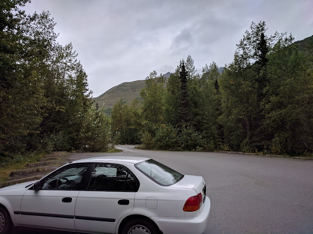
East Twin Peak 8/30/2017 - All Killer, No Filler

8.3 Mi/4:13:54/4544 ft gained

   I had several goals with this hike: enjoy a sunny (for once) day off, keep it short to keep my IT band happy, and test out my chest mounted gimbal on a scramble.  Sounds like a job for East Twin!

Obligatory Civic shot with the Twins lurking in the background
   I'd climbed West Twin a few weeks ago and was quite pleased with how short the approach is.  Basically, you just park at Eklutna, head up the Twin Peaks Trail, pass one bench, pass another, and boom - just head over to the Twins.  Easy peasy!

View from bench numero uno.  Bold is back there - in the cloud.
The twins coming into view on the way to bench two.
Bench two.  Take the trail on the right to climb Pepper Peak.

Stream crossing and East Twinny.

Oooohhh ahhhh it's getting nicer!
   The standard route for East Twin follows the south gully, and this is where I headed, noting that it wasn't really as great of a day as promised...  In fact, there were a few raindrops!  Some slices of blue sky began to develop as I climbed toward the gully, and eventually, the blue did take over the majority of the sky.  Nice.

Looking behind me as I climb - blue skies starting to take over

Down towards Eklutna

Fiery fall colors
   Passing some wary sheep, I reached the gully and began to scramble up.  And quite scrambly it was!  Lots of loose rock - I hugged the sides to get better grip.  A few steeper sections but nothing outrageous.  I was heavily reminded of the south gully on Eagle Peak.  Same thing here, just a heck of a lot shorter.

The wary sheep.

Scramblins
   Eventually, I reached some cairns that led right or left.  I didn't know what to make of these, so I decided to just keep going up the gully.  In hindsight I now know that these lead to more solid (if exposed) routes to the summit.  Oh well!  Next time.

More scramblins
   It was getting quite windy, as all the wind was being funnelled through the narrowing gully.  Quite a chilly wind too!  I was a bit upset that I didn't bring the wind covers for my thin gloves.  Finally, at the end of the gully, is a very narrow slot.  Past this slot, the wind was blocked.  Whew.  It felt good to get out of that.  It was just a few minutes of easy scrambling to the summit.

   The summit was windy too of course, so I only spent a few minutes before heading down.  I did get a good view of the other Twin, Pioneer, Bold (which had a lot of new snow) and the very menacing looking Goat Rock.  After some pictures and video, I went down.

Remember when I said I was a sucker for fast summit times?  My version of signing the register.

Pioneer Peak

Pioneer on the left, Bold on the right.

More Bold and Eklutna.

West Twin and Goat Rock.  WTF Goat Rock looks dang intensseeee.
   My poor hands were basically bricks for a while, thanks to my forgetfulness of the wind shells.  Once I got lower and out of the gully, they did warm up, but not without a good deal of pain.

   The way back down was uneventful.  I stopped at Eklutna to get several photos of Bold.  The day had an iffy start, but pulled a 180 and was now beautiful. Overall, an excellent peak for those days when you want something more brief :)

Back at bench one, the day is looking up!

Forest-y stuff

Forest-y stuff.

Dat Bold Doh

Have some composition.

The route.

Gimbal Video


                                                                            Links:

Wednesday, August 23, 2017

Koktoya/Tanainas - 8/23/2017

Koktoya and The Tanainas - 8/23/2017

20.4 miles/7:58:20/7858ft

   Once again, a typical late summer forecast - showers and rain.  Hmm.  What to do?  Bag some front range 5000ers is what!

My typical transition season gear.  
   I had the ambitious goal of heading up Near Point, jogging back toward Koktoya, and following the connecting ridges to Temptation, East and West Tanaina.  All of which had eluded me until this point.  At 6:18AM, I was at Prospect and ready to roll, rain or shine.

Civic - AKA adventure MACHINE
   I jogged to the Near Point/Wolverine intersection, then proceeded to slip and slide my way up to the top, getting plenty wet in the process.  It wasn't raining though, just morning dew, and the temperature was surprisingly mild.

Not looking too bad for a day that was supposed to rain, eh?

That nice looking trail dries up for a while...  Trust me.

Looking back toward Anchorage
   As I began descending the back side of Near Point toward the Campbell north fork, I recalled that this trail becomes difficult to pick up, especially at first.  This time was no different! The first few miles were touch and go - trying to figure out which side of the creek to be on!  Luckily, as you get closer to Mt Elliot and Long Lake, the trail is much more distinct and pleasant.
 
Long Lake

This makes me thirsty
   The weather was in fact turning more pleasant!  Looking south, I was surprised to see some slivers of sun above Mt Elliot, and fairly clear skies towards Anchorage.   All the same, Williwaw was certainly still in the clouds, and so was Koktoya.

   My plan for ascending Koktoya was to head up the mellow grass slopes past Long Lake, until I hit the south ridge.  This turned out to be a pretty decent plan, until I went into the reduced visibility of the clouds and spent a while navigating several manky gullies.  Definitely wasted some time in these!  The moss was quite unpleasant.

THE MANK
  Finally though, I reached the summit of Koktoya!  Rather ominously, there was a large bone up here...
Near the summit of Koktoya

Summit!

Note the bone on the summit.  WTF
   After spending a few minutes at the summit, I started following the ridge west and through the clouds.  I got several peeks at the Williwaw lakes below, and used them to keep myself going in the right direction.  The ridge meandered downward, finally coming out of the clouds and allowing me to see what was ahead.
The lakes were peaking through the clouds

Screw that, I'm going left.
   It looked like slow going!  I dropped south off the ridge for a while, reasoning that gaining the elevation back would be better than the alternative of staying on the top and scrambling.

  Eventually I went back into the clouds, and reached the summit of East Tanaina.  From here, I had a decision: do I go north, and to Temptation, or keep going west and the summit of West Tanaina?

   Unfortunately, the long approach to Eagle Peak last week really flared up my IT band, and it was already hurting considerably from another long day.  I decided I didn't feel like further gimping myself and opted to keep going west.
Me getting da rocks out

Nice ridge now!

Best ridge ever in fact

Summit Circle of East Tanaina!

   The ridge became considerably more mellow, and in no time, I was at the summit of West Tanaina!

Me having a nice walk

Summit of West Tanaina

Me walking ONCE AGAIN
   I toyed with the idea of also trying to link up Tikishla, but thought the better of it and began descending.

   And just in time!

   Looking toward Anchorage, I saw curtains of rain both to the west and the south, and there were clouds forming below.  I went down as fast as my knee would let me, and began heading back toward Near Point.
Looks like rain to me

Fog, aka The Nothing

   As I got close, the low clouds finally rolled in and visibility got downright terrible.  I trended up and forward, making it to Near Point without much difficulty.  Saw several people picking blueberries, and indeed - the blueberries were EVERYWHERE!

Green and white

I was just down in that

Misty goodness

Hey, that doesn't look so bad anymore

Looking south

   The rain remained light until I got to the car, which I was thankful for.
Moisture is the essence of wetness #Zoolander

Civic still looking good.
   Overall, it was a great day out - I stayed dry the whole time (well, except my feet) and knocked three peaks off my front range list!!  Awesome! Temptation - I'm coming for you.


   Also, the word of the day was definitely MANKY.  I couldn't stop saying it to myself :\

GPS Data: