Tuesday, July 5, 2022

Granite Peak Southwest Ridge - 3rd Time's the Charm!

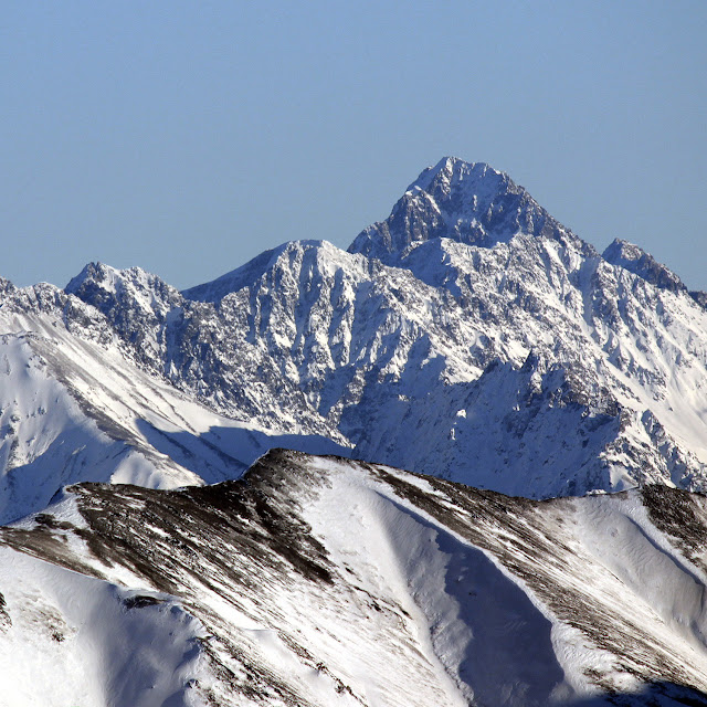
 Granite Peak Southwest Ridge - 3rd Time's the Charm!  

5.8 miles/2.7k gain to base of peak

2.2 miles/3.4k gain on the actual peak

   To put it mildly, this mountain has been elusive.  My first attempt saw me high on the peak, reaching the top of a gendarme, only to see a thunderstorm quickly bearing down.  Knowing how much fun mountain thunderstorms are (not), I turned back without hesitation.  The second try was more of a long shot - the weather was wet and socked in, and the mountain had some early snow.  No thanks.

   I'd often wondered if I wanted to bother with a third try on Granite, but the promise of a long bike downhill sealed the deal (you can hike too, but it's less fun...)  By 7 am on July 4th, I was driving toward Eska Falls.  

   Depending on what sort of vehicle you have, you may find yourself parking well before the real Eska trail begins.  My Corolla isn't much of an offroader, so I always park in a small gravel lot before the pavement ends.  The unpaved road is ROUGH!  

   Once on the unpaved road, you will want to keep bearing left/making left turns (small wooden signs guide you towards "HIKING").  Eventually, you'll reach a junction where the road splits into a motorized trail and the hiking/biking trail.  The hiking trail is more pleasant - less steep, albeit longer.  If you choose the hiking trail, get ready for a several miles of twisty turns, tight switchbacks, and some areas of brush.  

   As you break out of treeline, the mountain is clearly visible on the right, along with much of the SW ridge route.  Having already done this approach several times before, I quickly brought my bike up to its usual hiding spot.

This is about where I ditched my bike.  Granite is behind me, out of sight, while Eska Mountain is on the right.

   The initial climb heads up a grassy field, with long patches of turf meandering high up the peak.  The easiest way up is to follow these patches, continuing on until the first rocks/cliffs rear up ahead of you, then making a right turn underneath these obstacles.  

The first view of cliffs/gendarmes.  The initial choss filled ascent gully is on the left, mostly out of sight.

   Once you've traversed right and through some large talus, you'll find yourself in a gully filled with choss.  Head up, and trend climber's right as you gain elevation.  After about 1000 feet of this, you'll come out into a wide talus field with a gendarme upward and on climber's right.  Head for this gendarme!  

   Just before reaching the gendarme (literally right underneath it), traverse to the right of it.  This is where the route gets tricky.  You'll see a steep scree gully dropping downward into yet another, wider gully.  Go down this steep gully.  

The leftmost gendarme has the steep scree gully just below it, out of sight.  Go down this gully and then straight back up the very next!

   Once you're safely down, you have to IMMEDIATELY head back up the very next scree gully - don't bother trying to bypass more than just that one gendarme.  If you do, you'll be like me and end up having to climb/downclimb exposed 5th class boulders xD.  I had to write an emergency message to Dan asking him WTF to do.  

I just came down the snowy gully.  The snow-free gully in the foreground (right next to it) is the one you want.  In this photo, I had gone too far!

Fifth class boulder moves I tried and then had to downclimb.  I was messaging Dan from this vantage point and asking him what to do...

   If you've gone up the right gully, it will spit you out on the other side of the mountain, and from here, it all falls into place.  The rest of the gendarmes are easily avoided on either side, and the climbing remains in the exposed 3rd/easy 4 class category.  Once I bypassed these gendarmes, the summit came into view.  

Looking back down at the gendarmes I finally bypassed

   As I reached the summit, I was treated to beautiful views of both the Talkeetnas and the Chugach - Skybuster loomed proud to the south, and Apollo loomed proud to the north (I'm coming for you, Apollo). 

Looking north.  Apollo looming back there on the left.

Skybuster/Ice Cream Cone looking appealing as ever

Pano looking south.  The sun stayed in the whole ascent...  I'm not going to complain.

   Miraculously, the hot July sun stayed behind clouds for the whole ascent and most of the descent, which I was grateful for.  Even so, I ended up drinking all of my 2 liters of water before getting back to the bike.  It was a moderately thirsty, but entirely enjoyable shred back to the car.

The bike was waiting for me!  Eska falls and Eska Mountain in the background.  

Quick video from the way down.  I met two other riders on the trail!  


Friday, November 13, 2020

On breaking your neck...

   It's been nine weeks.  Nine weeks since I lay staring at the ground, struggling for breath, hearing my own strangled sounds of pain.  I knew I would be OK.  I just needed to breath, and everything would be OK.  I didn't realize that my past and future had just been in a violent physical collision.

   I breathed.  I managed to sit up.  The world got brighter.  

   I lay daydreaming in the hospital.  My narcotic haze was pierced by words I heard in the hallway.

   "Fractured."

   "Pneumo."

   The doctor stepped in.  He looked right at me.  

   "You have two fractures in your neck.  You have a fracture in your back.  You have multiple rib fractures and a pneumothorax in your right lung.  You must be a very tough guy."

   I didn't feel tough.  Fear welled up in a way I'd never felt before.  Breaking your neck isn't something that happens to me - that's for other people.  People who know how to live in wheelchairs, people who know how to make the most of things.  Did I know how to make the most of things?  

   "I'm turning you over to a neurosurgeon.  We don't think you will need surgery, but we need more images." 

   Some consolation.  But the damage was done.  Finally, I'd done it.  I'd broken my neck.

   Getting the required images meant I had to stand up.  Every time I tried to roll into position, my ribs screamed at me to stop, lay there, give up.  And I did give up, many times.  The words of the PT echoed in my head "breath, you've got to breath.  Your muscles will seize if you don't breath."  And of course, he was right.  I breathed, slowly, deliberately, purposefully, and I managed to sit up.  

   I went home, plus neck brace, sans surgery.  The weather was warm and the early fall colors golden.  My friends and family talked to me and reassured me.  I walked through the park with my uncle.  How strange and childish it felt - hazy, long ago memories of playgrounds, grass and family.  Was it a lifetime ago?  Was it yesterday?  Is this how it would feel in the final years of my life?  Who would I be walking with, and really, who would I be, by then?   

   Weeks came and went.  I was allowed to shower. I went back to work.  Normalcy made an appearance, and it gave me something to move towards.  I walked as much as possible and my body played along, for the most part.  Eerie phantom sensations appeared from time to time, sometimes trickling like water, sometimes crawling like bugs, with no apparent cause or solution.  They are scariest at night.  

   There are less than four weeks left of anticipated neck brace time.  I wonder what it will it be like on that wonderful, expectant day.  What will I eat for breakfast?  What will I wear?  Will I cry?  It might as well be a lifetime from now. 

   ...But I know it won't be that long.  I'll blink and it will be over.  The past and future will come to crossroads, and I won't be on the ground.  I'll breath and I will be OK.  I'll blink and it will all be over.

Sunday, August 23, 2020

Ice Cream Cone/Skybuster Mountain 8/22/20

Skybuster/Ice Cream Cone seen from Mt. Significant, January 2019.  LONG lens!


   I remember the first time I saw it. Eastbound on the Glenn, just before passing Kings Mountain and Chickaloon, on a clear, flat section of road, I happened to glance south, and there it was, standing tall in the distance. I couldn't take my eyes off, and couldn't help but wonder: did that insane tower of rock have a name, and what would it be like to stand on its incredible, precipitous summit? Since I wasn't driving, I easily answered the first question with Google.

   That inspirational behemoth was named Skybuster.

   Answering the second question, however, would have to wait.

   Several years and lots of beta gathering later, it was time to try. Since the peak is so remote, it seemed a good idea to make this our first fly in approach. With excitement and some apprehension, we loaded up at Merrill field and flew (choppered!) out.

WOCKA WOCKA WOCKA

Sitting in the chopper at Merrill field.

Fueling up in Palmer.

   Cruising by the familiar landmarks of Vista, Twin Peaks and Pioneer was a surreal experience, yet nothing compared to the insanity of landing below the south face of Skybuster mere minutes after departing Anchorage. I swear it feels like it SHOULD have been more difficult. We waved farewell to our chopper buddies, and they were gone.

This would have been part of the human powered approach.  Might've taken a while!

Chopper friends!

BYEEE!

   Since we arrived in the early afternoon, we had plenty of time to investigate our camp site and walk up to our intended route. Snow conditions were the biggest concern (followed by rockfall), but a brief investigation of the gully above proved more favorable than expected for both. The new concern was the narrowing of the upper section of gully - from below, it appeared a potential technical challenge, but was impossible to say for sure. We vowed to give it an early start tomorrow, and returned to camp for a good brew.

This was an amazingly perfect camp site.

Studying the route for tomorrow's attempt.
Ooooohhhhhh ahhhhh pano!

   Some rain showers moved by throughout the night, but were interspersed with long periods of amazing star visibility. I propped my phone on my pillow and capitalized on this - I had long been waiting to try the Pixel 4 star photography. Seriously impressed with one of the shots I got.

Night sky.  Amazing what a modern smartphone can do.

   The following morning, we departed at first light and quickly french techniqued our way up the wide snow field at the bottom of the gully. After crossing several runnels (and encountering some nice WI therein) we came to the narrowing section we had worried about.

Trudging to the snow...

Trudging UP the snow

Finding WI!!

Gimme summa dat WI plz

   As it turned out, the first step was easy mixed terrain, followed by several more steps of easy ice and snow, leading eventually to a wider gully with more snow. From here we gained the summit ridge.

Cody topping out on the (quite) easy mixed section

The rest of the narrow gully.  Some ice up there that may just edge into WI2 territory, if I'm being generous ;)

   I had heard a lot about this summit ridge and was expecting some srs bsns, but we found nothing worth roping up for. The rope stayed in the bag all the way to the summit.

Typical summit ridge.  There was ONE gendarme that was easily dealt with.

   The summit itself was a slightly anti-climactic mellow snowfield with a severe drop on the north side. Unfortunately, clouds had moved in and obscured our hopes of seeing far and wide into the Chugach, yet we did have a small break in the clouds looking northward. It was nice to get at least SOME views!

The Moistboyz, aka Krusher and co., aka Send Squad, aka Beavis and Butthead 

The view to the north.

   We descended in deteriorating weather (snowflakes!) and finally broke out the rope to rappel the mixed step. A slung horn with a bomber piton backup saw us down without trouble. As we descended the wider snowfield, we did see some random rockfall that hastened our downclimbing speed, yet we made it back to the tent without incident.

   Through the magic of an early start, combined with a chopper drop at 5k feet, we realized we had finished way ahead of schedule - it was only 12pm. After some deliberation, we figured it best to try to leave early, given the questionable weather. A quick InReach text later and the chopper was on its way back for us.

Things were starting to look a bit worse down here.  The rain was soon to follow.

   As we waited for the WOCKA WOCKA, we packed up camp and wondered at the strange weather. Several rock towers in the distance were being hidden by sheets of rain, and sure enough, the rain came our way and started drenching us with frigid wetness. Luckily, the chopper arrived not much later, and we thanked our pilot profusely for our "rescue".

   Once again, it was a surreal flight back to Anchorage. One moment we were freezing, next moment we were in the sun at Merrill field. Big thanks to Kodiak Helicopters, our pilot Chris and his assistant Bridget. Super flexible flight plans, very professional and very affordable. I think I could get used to this!


Monday, December 30, 2019

Best Photos of 2019

January
Cumulus Mtn (left), with Korohusk peak in the center.  Extremely low snow for a January day!
Josh Chelf was all smiles while crushing the bike leg of the TriFlake winter triathlon.
Jacob Kirk spent the whole race in plaid - and went on to place third in the individual division!
Local running legend Matias Saari - on skis?!  
February
Tyson Flaharty of Goldstream Sports fresh off his ITI 350 win with a bike still fully loaded with gear.  Interview on my Youtube channel!
Beautiful blue ice behind Ptarmigan Peak.
James Stull riding in Phoenix, AZ.  We brought Alaska with us - the coldest temps in 125 years!
OMG WHAT IS WRONG WITH ZAC'S FACE?!?!  We were driving back from a trailhead in AZ when we first saw this - and nearly crashed the car from laughing so hard.  
March
March means the return of the sun, and the death of eastward facing ice climbs.  That same beautiful blue ice from February is being sun rotted, but that's OK because it means spring is coming! 
Ice ice, more ice.  The terrifying and aptly named Hollow Icicle near Echo Bend on the Eagle River.  Cody and I just finished rappeling from a rather harrowing ascent.  Nobody fell inside, but it was a sobering climb all the same.  
How it felt to be done with Hollow Icicle!  
April
On my way back from summiting the Watchman (right).  Eklutna Lake is behind me, and luckily, crossing the stream braids was quite easy at this time of year.
View of Polar Bear and Eagle Peak from camp below Mt. Yukla (out of frame on the right).  The next day, Cody and I would have a serious avalanche scare above Twincicle Glacier, prompting hasty retreat.
May
I'm CRAZY, and CRAZY HAPPY to be doing some spring rock climbing at Pivot Point! 
Traveling on Explorer glacier with Cody, Joe, and Dan.  The wet avalanche danger became a little too exciting in the hot afternoon sun, foiling our attempt on Explorer Peak.  We turned back when Dan encountered waste deep isothermal snow.  Bad news!
Being on a glacier is like being on a beach - prepare to get sun fried.  Dan captured a very candid moment of Joe and Cody catching some quick z's in the back of my Civic.  D'awww.  PC Dan Glatz. 
June
Lupins and mountains.  Returning from an attempt on Benevolent Point (background left)
Video still of me riding on Eh Line.  The new Singletrack Advocates trails are killer!  Video/Photo credit - Reese Hanneman
Summit boulder of Troublemint Peak.  I didn't like the prospect of climbing down this side of it, so I chose the other side.  
The other side of Troublemint's summit boulder.  Surreal granite spires under a hot June sun!
July
4th of July Alyeska rippin' with mah boy, Adam G!
Awe inspiring view of the Eklutna glacier from high on The Mitre.  
Video still from the White Princess summit glacier.  By far the most "big mountain" feel of any peak I have yet climbed.  We traveled carefully - it was hard to tell just how many crevasses were under our feet, but we suspected it was a lot.  Several times I punched through what I thought was crust, only to see a dark hole when pulling my leg out...
White Princess summit!  
Portrait of Cody K!
August
Summit of Three-Bell Spire, looking east out into Minty goodness.
Summit of Triplemint, looking back toward Three-Bell (center, right above foreground rock.) 
Even more quintessential Minty views!  Just above the MCA's Mint Hut (out of view behind the hill on the right)
September
Closing day at Alyeska.  PC Zac Cole.

WARNING - GRAPHIC 
Click if you're OK with blood and bone
September 21 saw my worst bike injury to date, and that's after 15 years of serious riding.  I flayed open my knee capsule with an extremely sharp rock, spent several days in the hospital, and am still working toward full recovery.  Bill Finley of akMountain just happened along while I was laying waiting for the ambulance, and has an Instagram post here.  At least I was all smiles!  Also - thanks Lang, Chris, Andy, Sophie, Jon, Jon (another Jon) for helpin' me out while I was laying there, and Cody, Jamey, Zac, Jeff and Rene for visiting me in the hospital.

Oliver Sternicki pinning it during a ArcticCross downpour.  I was hobbling around taking photos with my recently injured knee ;) 
Action hero James Stull during the same downpour as above.
October
Winter returns to AK!  Skybuster/Ice Cream Cone Mountain hiding background left.
Matanuska river with the "A" peaks background left.  I want to say that the prominent visible peak is Awesome, but Awesome may indeed be lurking further back in the clouds.
Frosty blue tones looking west along the Matanuska river.
November
Above the clouds on Indianhouse Mountain.  My footprints are visible to the right, leading up to the ridge. 
Descending to Falls Creek - back into the clouds after summiting Indianhouse.
December
New phone day!  Taking the fatbike out for a photo shoot with my Pixel 4.
Coworker Bill Johnson on the right side of PFM Wall.
Josh P. shwacks his way up to enjoy a couple laps on the top rope he set.